|
XC flight details Author Pilot profile Glider
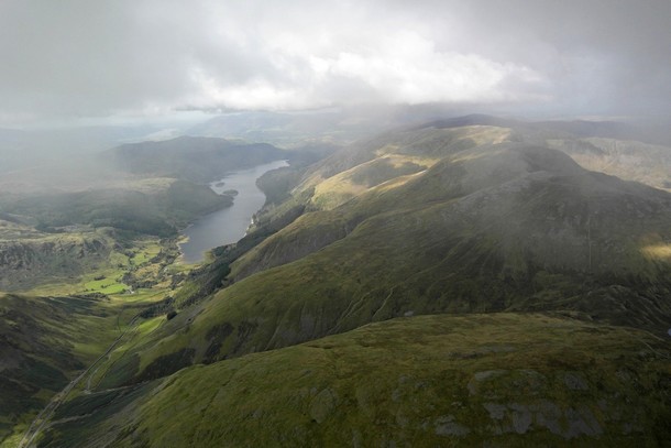
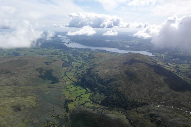
Taking off on Clough mid afternoon the wind was light (I'd already had to side land together with Dave Robinson and Jim Kenyon). There was a lot of cloud and not a lot of sun left on the ground and I thought chances were the next flight would be a flydown; I didn't even bother fixing my cockpit and just stuffed my vario/gps (on loud) in a pocket. I followed Dave and Jim up and tried to get into some lift Jim had found on the west side of the cliffs. It didn't seem so strong but was reliable and kept going most of the way to cloudbase which was probably around 4000' judging from my tracklog.
Suddenly I noticed cloud forming behind me, I'd say a few hundred feet below base. Sea breeze front I was assuming and I made sure I was topped up as I pushed south towards Helvellyn. Then I started to sink, I pushed the speedbar forward and lay back thinking I'd top up again over Helvellyn as I have in the past, but like Jim ahead of me I sank all the way to Seat Sandal and I thought I'd be lucky to make Grasmere.
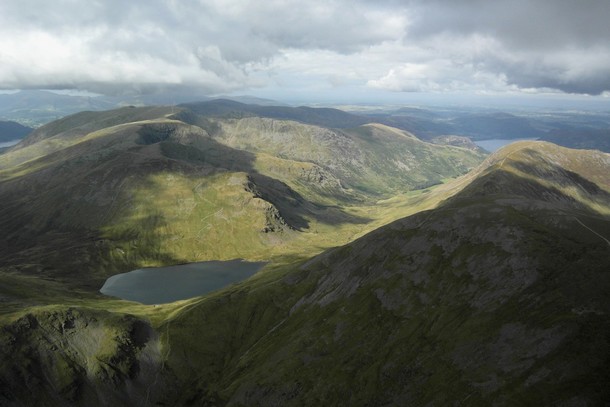
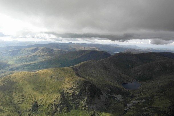
Sure enough I'd been under fairly thick cloud pretty much since Clough and now looking south it was mostly blue sky with smaller cumulus clouds. Had I just flown from the north edge of sea breeze convergence through a sinky middle bit to a lifty south edge? I was drifting as though still in a light NW and surely if this was sea breeze now from the south I should be drifting in a S/SW breeze? Once again at base I dithered for a minute. I didn't rate my chances for flying back north to Clough cause if the light NW had picked up at all I'd struggle to get my DHV1 to get back through the sinky patch over Helvellyn.
On reaching Fairfield it looked like I was now in a light SW as I topped up again. It seemed to be a simple case of heading for the edge of the big dark stuff and the lift would be there.
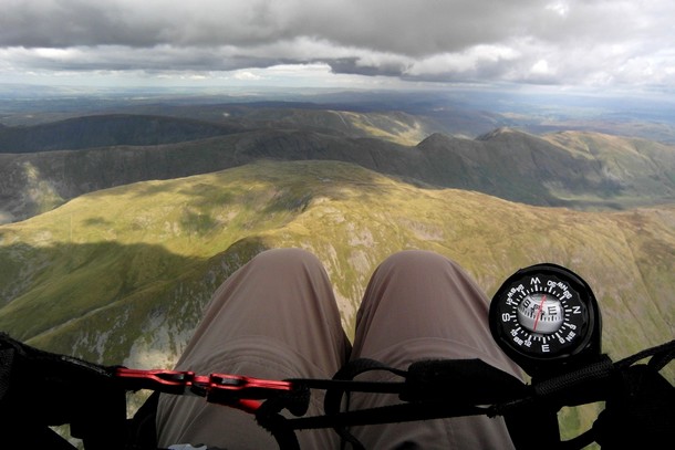
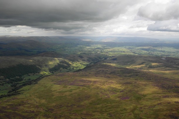
There hadn't been rain forecast so I thought just stay near the edge and follow it east. What with the fairly low base I'd made sure I had my compass strapped on my chest strap and I'm glad I had. After passing over Kirkstone pass onto Stony Cove Pike to top up once more, I found cloud developing around me and much stronger lift. I was suddenly engulfed in cloud and thought I better try a spiral dive to just burn off a bit of height (I knew there was about 1500' of clear air between base and the hilltops).
I was feeling more 'g' than I've ever flown but the vario seemed to be registering even faster climb (tracklog shows a short spell around 5ms). Okay... try big ears and speedbar (no - I didn't believe that was really going to work either; and it didn't). Luckily the previous Sunday I'd gone along to coaching and had a good chat with Mr Ashcroft (CSC chief coach) about cloud and when to be cautious and when to learn not to be such a sissy. He'd recommended the spiral dive but obviously I'd need more practise at that. His other tip was to just chill out (literally) and use the compass and speedbar to fly out the side. [John later recalls: "Trying to take a compass bearing south was a disorientating challenge. I felt I was flying straight but my compass was turning... with zero visibility it took a moment to realise it was the cloud turning me - I had no idea that was possible. I couldn't feel the flat turn at all but my heading was changing at quite a rate and I had to put in significant right input to get the compass steady, I was then able to adjust to get the course I wanted."] After a couple of minutes I could make out the faint yet welcome sight of land, and then as it cleared the views were stunning, now at 5,500ft above a base of maybe 4000ft.
Definitely an eventful flight and a lot yet to learn from it.
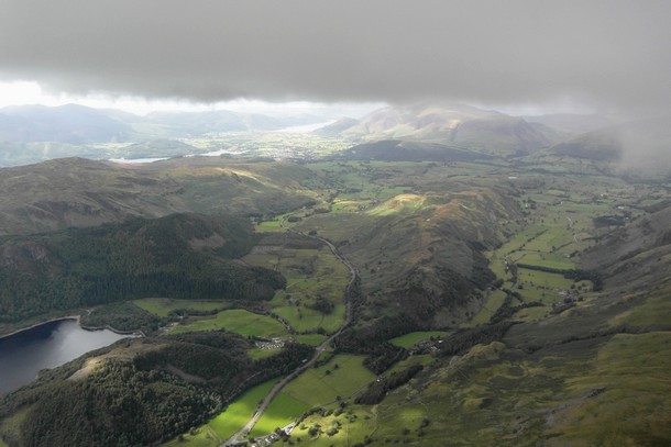
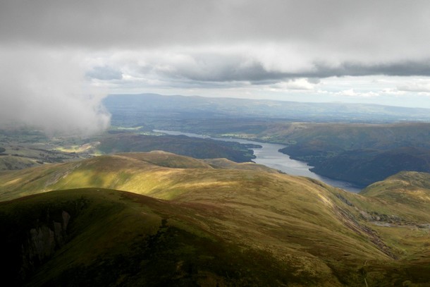
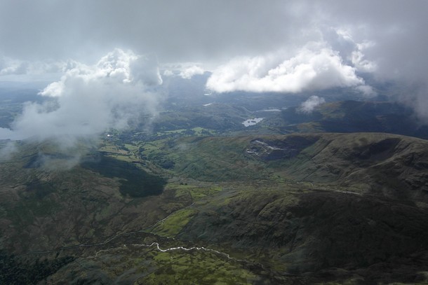
From the photos there is definite evidence of sea breeze front (SBF) action in the area. The 'steps' in cloud base are one sure sign as are the 'wispies' forming at a lower level than the general cloudbase. As you'd expect the sea air appears to be from the north west to the north of Dunmail Raise and from the south west to the south of the border (sorry, I mean pass).
This becomes doubly worrying in windy conditions when exiting base on the downwind side (when upwind penetration is severely limited) would potentially put you on the leeside of the mountain. The combined dangers of black sucky clouds, base not high above mountain tops and wind too strong to risk ending up leeside, make for a trap that takes away your options. Add to this the fact that base can suddenly drop 1000ft in the entraining sea air and you have a recipe for trouble. Recognize the trap before you're in it and you can stay safe.
The way I fly these conditions is to try and stay a few hundred feet below base (more with a higher base) and, with half bar on, try and steer a course that maintains my height whilst making progress in roughly the right direction. If I start going up towards cloud I pull the ears in and track towards the nearest exit from under the base within 90 degrees of my desired course and if I start to lose height I head back under the black stuff and top up. It's a balancing act that once mastered, allows you to make great progress, even upwind, without really turning. Bear in mind that on the upwind edge of the cloud there will likely be a sharp transition from lift to sink and on the downwind side a more gradual petering out of lift, making it easier to 'ride the zero line'
I would suggest B line over a spiral as you basically remain under your wing without too much energy. Better still to fly on a heading til you exit cloud. Practise instrument flying in full vis' before you need the skills in anger. Great flight John. I'll bet you can't get the images out of your head!
|
|
|---|---|---|