WNW - NW |
Walla Crags |
| Status : | OK | ||
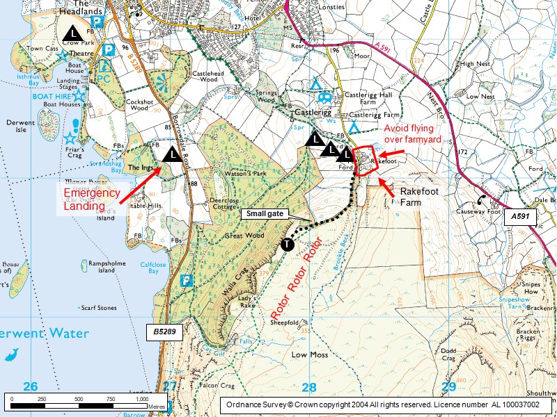
| IMPORTANT - Restrictions on use | SAFETY/NOTAMS: - IT HAS BEEN AGREED WITH THE RAF that PG/HG pilots will NOTAM this site prior to ANY MID WEEK FLYING BEFORE 6pm. - This site lies directly in the path of one of the busiest military low flying corridors in the country. - BE WARNED: Flying ANYWHERE on the EAST SIDE OF DERWENTWATER midweek before 6pm without a NOTAM is very dangerous. There have been a number of terrifying jet/paraglider AIRPROX incidents before this rule was introduced. - Midweek, even after 6pm, a NOTAM is advised. - To raise a NOTAM use: https://canp.logans.me.uk PARKING: Keep the head of the road clear of parked cars, park with consideration. |
||
| Last Updated : | 29/03/2026 at 02:16 by Rick Livingstone | ||
| Wind : | WNW - NW | ||
| Nil Wind : | No | ||
| Grid Ref : | NY277214 | Height (AMSL) : | 1210' / 369m |
| Site Code : | 17.078 | Top to Bottom : | 450' / 137m |
Location
N Lakes - S of Keswick
Details
An excellent light wind site; can be inter-flown with Latrigg. The cliff edge requires a take-off with conviction! Not good for nil/very light wind forward launches, due to flat top & limited space. This is a good reliable thermal site and is in the right place for convergence. Also a classic afternoon site in a gentle seabreeze.
Site Officer
:
Postcode for Sat Nav Systems (read the Health Warning!)
CA12 4TE - This is the closest mail delivery point to the flying site and is positioned at:
Just north of Castlerigg Farm which in turn is 500m north of Rakefoot Farm
Getting There
Approach from the A591. Descending into Keswick from the south, take a minor road on the left leading to Castlerigg campsite. Parking space is limited to 6 cars. DO NOT block road/access to Rakefoot Farm. There is a possibility of parking at Castlerigg campsite - a donation is required.
Getting to takeoff
From the road end climb the hillside heading towards the right following the line of the field boundary. The take off is 30m beyond the small gate.
Permission to use site
Rakefoot Farm, Castlerigg Farm and The National Trust
Hazards
THIS SITE LIES IN THE PATH OF THE BUSIEST MILITARY LOW FLYING CORRIDOR IN THE COUNTRY. THIS SITE MUST BE NOTAM'd PRIOR TO ANY MID WEEK FLYING BEFORE 6pm (https://canp.logans.me.uk).
In moderate winds rotor may exist some distance back from the edge of the cliff and wall.
Take Off
Correctly identify the two take-off points. There is a small, flat heather covered rigging area in front of the wall 30m beyond a small access gate. The first take-off is just in front of this. The second take-off is 20m further on at the slightly higher rocky knoll.
These are cliff take-offs, where it is rarely possible to build a wall with your wing so a commitment take-off is required. Take-off can be aborted in light conditions if done quickly.
Whole site is not good for nil/light wind forward launches
Landing Areas
Official landing field is near to Rakefoot Farm, from the lane go through the gate and over the stream, up the bank there are 3 fields which are connected by open gateways. If there are cows in a landing field please choose an alternative empty field (cows are only put in these fields when they have young calves). Good idea to check out the landing field before flying, if it’s your first time here. From the air, approach with care as trees near the farm are quite big. It can be lifty over the landing fields.
If you lose height by take-off, you need to make a quick decision when to turn and head for the landing fields - if in doubt head out and land at the bottom.
Avoid overfly the farm buildings due to the farmer’s concerns about scaring their sheepdogs.
It is possible (but not common) to top land if you stay well back and land sufficiently far behind the wall to keep clear of rotor caused by the cliff edge and wall.
OK to land in one of the empty fields alongside the Borrowdale Road at the bottom.
If you fly down towards Borrowdale, beware there are some areas between the Youth Hostel and take off where trees mean that there are no bottom landing options. Once you reach Lodore Hotel (you’ll see their outdoor swimming pool) there are lots of landing options.
Flying
Excellent lifty site, particularly in late afternoon sea breeze/convergence/restitution. Can be thermic.
XC potential
nice ridge runs down towards Borrowdale and further afield.
Photos
Click on the photo for a full size image.
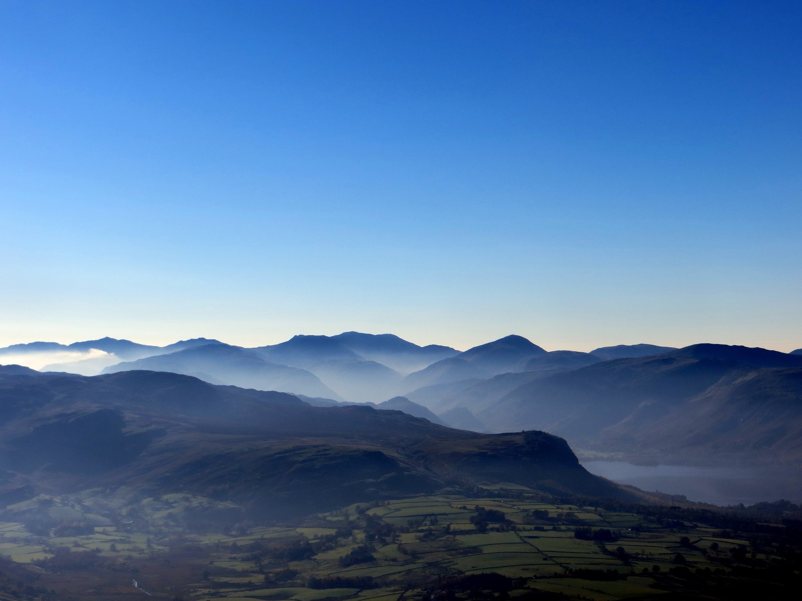
| A panoramic view of the North Lakes, probably taken from the Blencathra area. Walla Crags is the steep ground with Derwent Water on its right. Photo by Mike Harper. |
 |
| Looking to the SW with Derwent Water on the right |
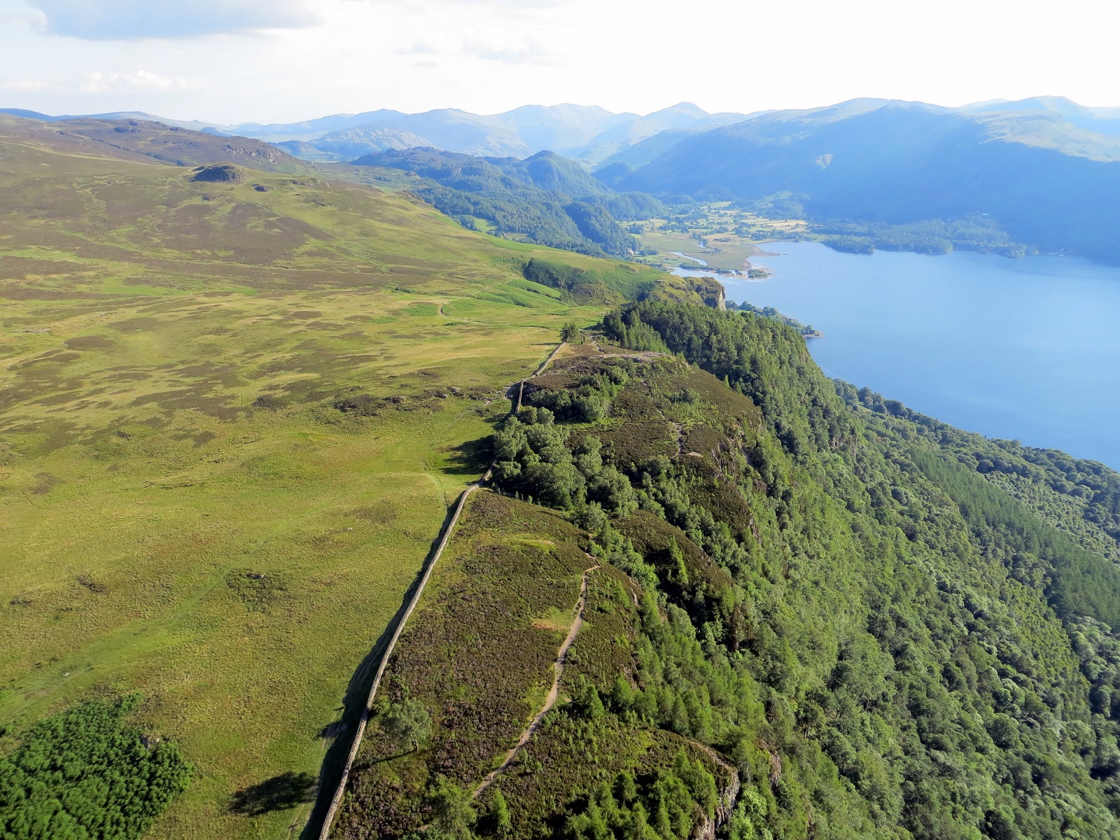 |
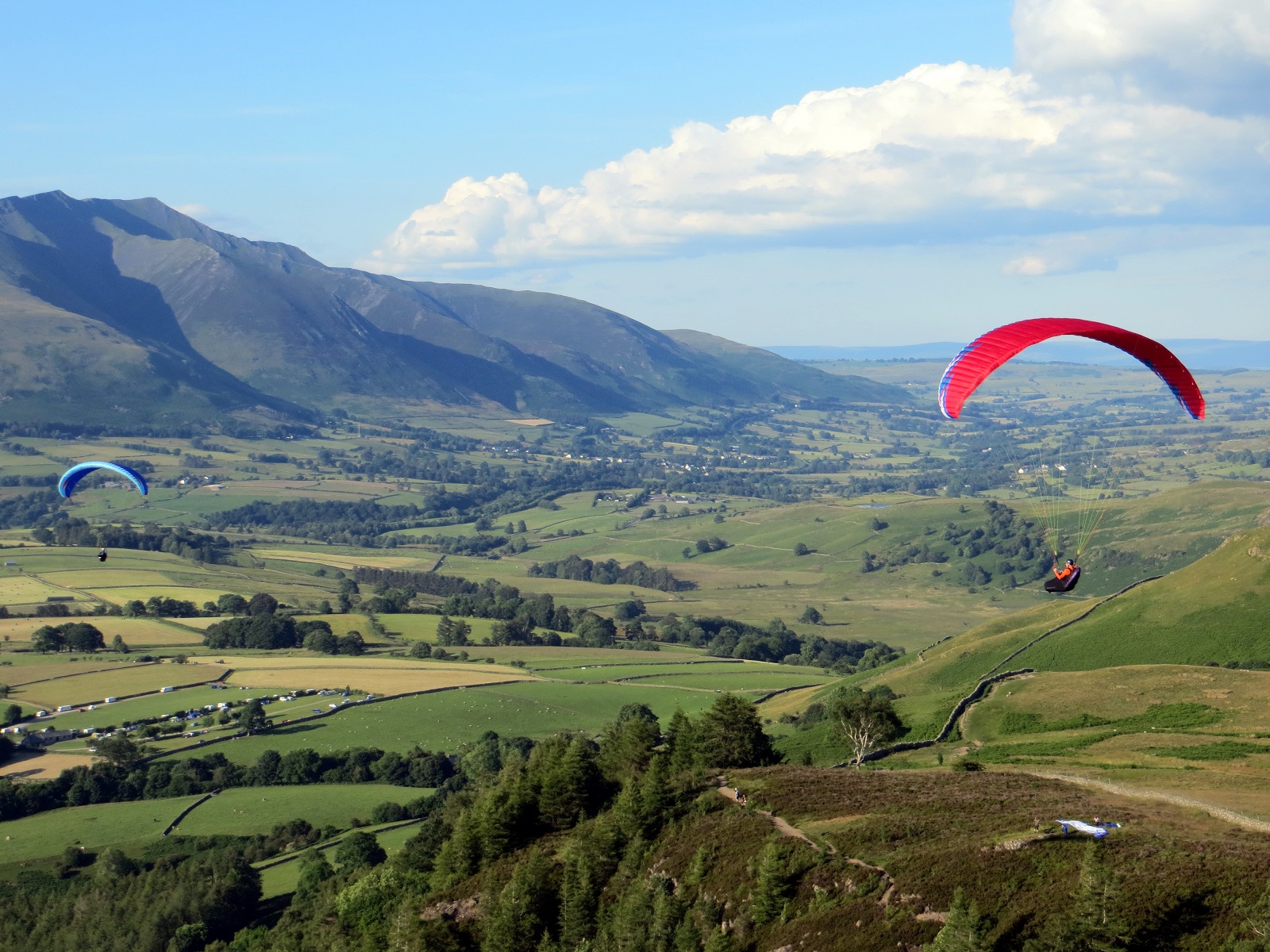
| Walla Crags from the air with Blencathra in the background. 2 gliders are in the take off area. Photo by Peter Rycroft. |
 |
| Another view of Walla Crags looking north east. Photo by Mike Harper. |
 |
| One landing option is Crow Park nexy to the Theatre by the Lake in Keswick. Photo by Mike Harper |
 |
Local Information - Pubs/Food etc
Nearest pubs to the site - for post flying debriefing only! You may find details of other facilities here
| Heights Hotel, Keswick | |
| Grid Reference : | NY282226 |
| Distance from Site : | 0.3 miles |
| Notes : | The Heights aka Cragg Bar serves Lakeland Gold which is one of the best beers around. The quality of the beer is a bit variable but the beer garden is stunning and generally quiet. They have a menu of vegetarian food and out of date snacks. There's plenty of parking in their car park or the layby next to it. Midge repellent is advisable. |
| Click here to see the place in Google Street View |
This page shows records for this site. Some of the older records are not very detailed. More recent records may have an igc file available You can right click and download this to your PC. You can then use IGC Flight replay to view the flight.
| Paragliding |
| Open Distance XC | |
| Distance : | 32.5km |
| Date : | 14/05/1996 |
| Pilot : | Mark Stuart |
| Hang Gliding |
| Open Distance XC | |
| Distance : | 57.9km |
| Max Height : | 5350ft |
| Date : | Unknown |
| Pilot : | Unknown |
Data Resources
Follow the links to see the site in Google Earth and Google Street view. To access the former, you will need to have Google Earth installed on your PC. You can also upload your flights to GE - use GPS Dump (Links Page) to convert a variety of GPS file formats to a GE kml file.
| Link | Resource Type | Notes |
|---|---|---|
| Google Earth - Car Park | ||
| Google Street View - Parking | Keep the lane clear! |
Walla Crags Map |
Legend |