W - WNW |
Troutbeck |
| Status : | OK | ||
| IMPORTANT - Restrictions on use | Experienced pilots only. Strictly no dogs. Do not block the track and close all gates. Beware of a new tree plantation North of the wall below take-off. The landing area just to the north of the reservoir is excellent but take care in strong winds as you might experience rotor. The valley landing is emergency only and should be avoided. If you think you may land in the valley check with the occupier at Long Green Head first. While there are no lambing restrictions on the fell the usual courtesy to avoid fields with livestock is essential for preserving our good relations with the farming community in this valley. |
||
| Last Updated : | 03/09/2025 at 20:13 by Jacob Aubrey | ||
| Last Reviewed : | 31/03/2021 by | ||
| Wind : | W - WNW | ||
| Nil Wind : | No | ||
| Grid Ref : | NY423032 | Height (AMSL) : | 1280' / 390m |
| Site Code : | 17.076 | Top to Bottom : | 850' / 259m |
Location
Central Lakes - N of Windermere (Town)
Details
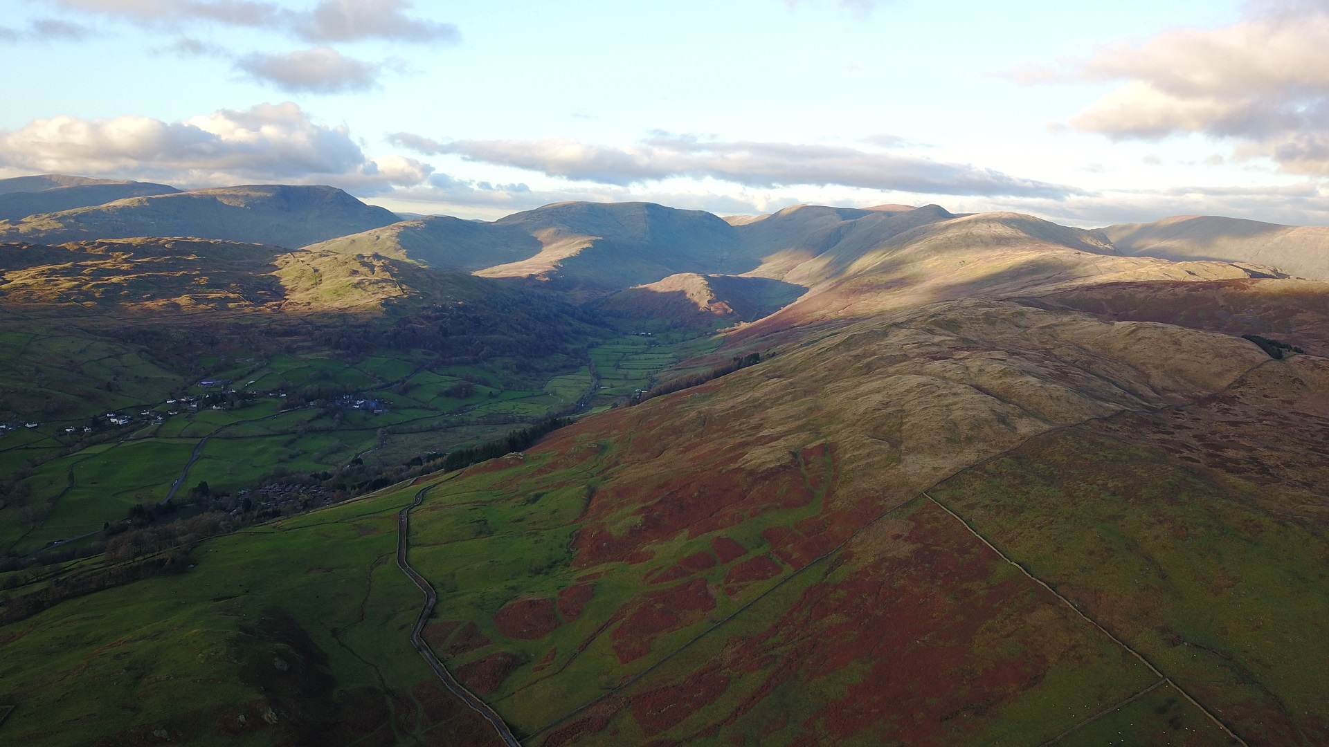
An excellent and impressive ridge site overlooking the Troutbeck Valley. The ridge runs north / south and rises to some of the higher fells of the Lakeland area.
Site Officer
Jacob Aubrey : 07505 265668
Postcode for Sat Nav Systems (read the Health Warning!)
LA23 1JR - This is the closest mail delivery point to the flying site and is positioned at:
Broadgate Farm. This postcode centre is a considerable distance from the flying site as there are no other delivery points in the area. If approaching from the east, the farm is on the road from Ings. Use with caution if approaching from any other direction.
Getting There
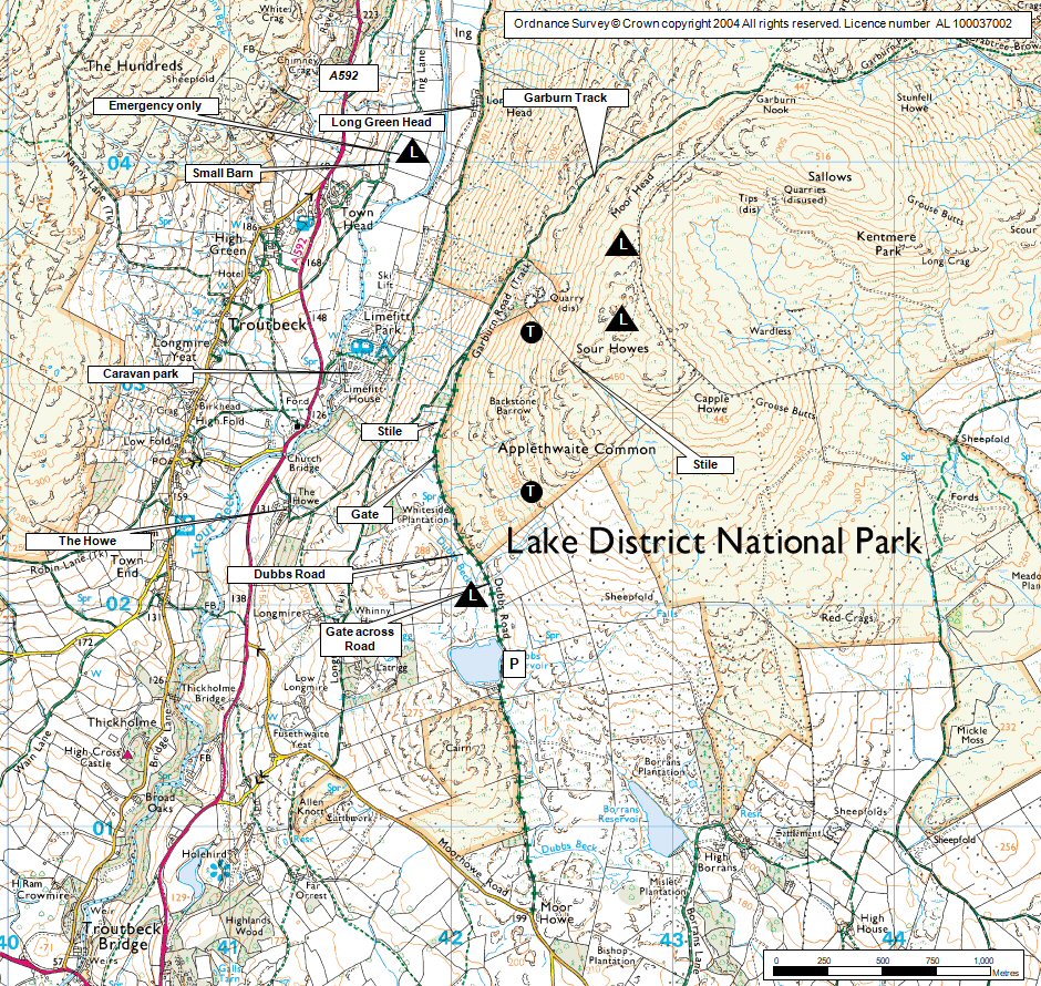
Approach from the A591. Turn right at Ings (going west) and follow a minor road for about 5 km to a left hand bend with a good unsurfaced road leading off to the right. Cars can be left at the start of the track and pilots should double up as there is very limited parking at the end of the track.
Do not go past the gate marked on the map, just north of the reservoir. The track is in poor condition and parking is very restricted. Don't park adjacent to the reservoir as water company employees frequently park there. There are some parking places 50 ft beyond
Getting to takeoff
From Dubbs Reservoir follow the track until it joins the Garburn Track on the right as it rises from the valley below. At this point climb the stile to the right and gain the hillside above to a take off point 50m above. Once past Dubbs Reservoir, the track deteriorates significantly and is really only suitable for 4 x 4 vehicles.
Permission to use site
Howe Farm and Long Green Head
Hazards
Depending on conditions it can vary from excellent with good thermals to downright rough. Turbulence increases as the wind goes north of NNW or above 16mph. It can be rough in the valley in even moderate winds. Only use the valley bottom landing as a last resort.
Slope landing North of the wall should be exercised with caution due to a new tree plantation. A pilot skewer is not ideal for anyone.
Top landing is a little awkward and a reasonably flat spot should be sought out from the air before attempting; there are lots of small hillocks.
Bottom landing is down the road from the cars by the small reservoir; inspect this area first before flying. It is recommended that a windsock is placed by the reservoir.
Take Off
The SW take off is fairly shallow and short and only useful if the wind goes off the hill to the south (common - due to sea breeze sweeping up Windermere).
Landing Areas
Slope landing North of the wall should be exercised with caution due to a new tree plantation. A pilot skewer is not ideal for anyone.
The landing area just to the north of the reservoir is excellent but take care in strong winds as you might experience rotor. The valley landing is emergency only and should be avoided
Flying
The site is fine in light winds but stronger conditions can lead to turbulence. The farmer is not keen on paragliders. Please limit any 'scratching' if possible.
XC potential
Brilliant XC potential; Wether Fell is 45km downwind and can be used as a staging point for exploring areas of the Yorkshire Dales and beyond.
Videos
Follow this link for a 360 degree panorama of take off at Troutbeck. 2 people are sitting in the take off area. This starts in the lower right hand corner of the video and changes to lower centre during video. Take off is near an area of scree.
Photos
Click on the photo for a full size image.
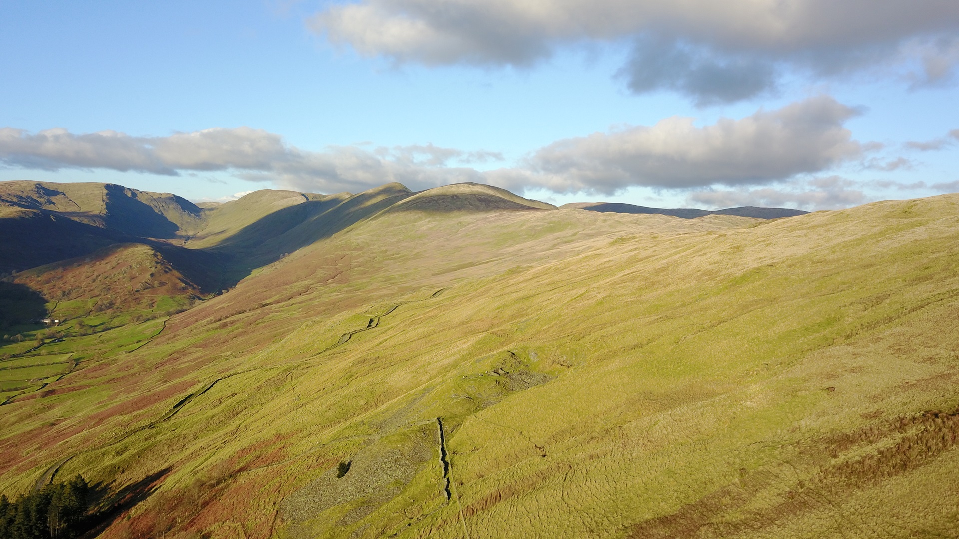
| Looking up the Troutbeck Valley. The col in the centre of the picture lies between Stoney Cove Pike on the left and Thornthwaite Beacon on the right. The take off is in the centre of the photo above the woods |
 |
| This is where you leave the Ings to Troutbeck road and turn up the track on the right. If you want to look after your car park here. |
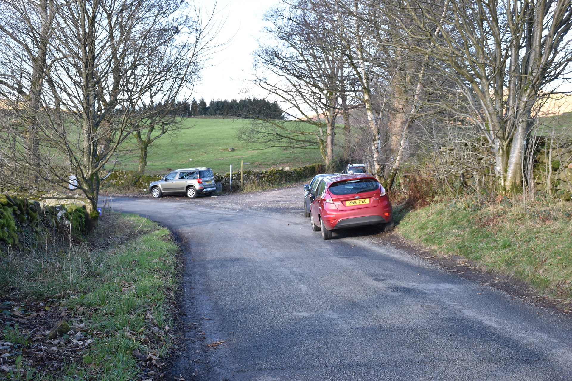 |
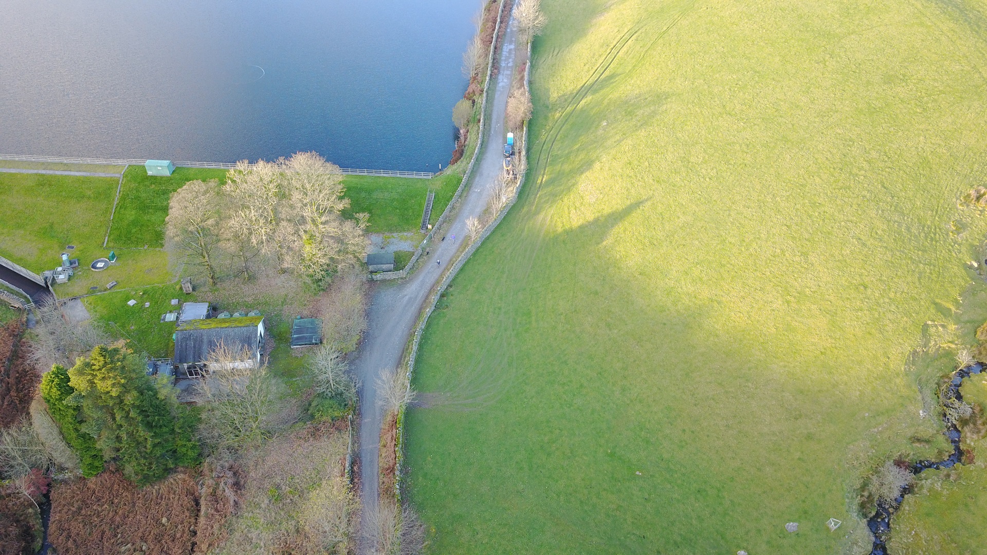
| After a kilometre up the track, you will reach Dubbs reservoir. Try not to park in the triangular area as this is used by the water company vehicles. If you can, park where the toilet cubicle is situated, about 50 yards from the triangular area. Past this point, the track deteriorates quickly and parking areas are very limited. |
 |
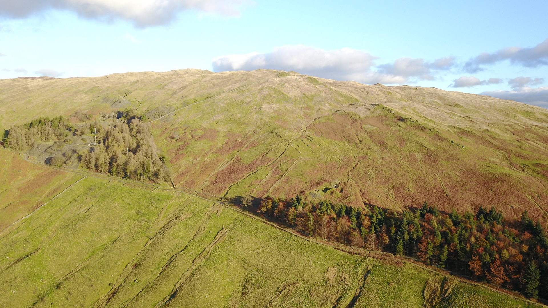
| A general view of the site looking east. The Garburn road climbs diagonally from the bottom right. Note the 2 small communication towers in the woods to the left. Take off is in the centre of the photo and is halway between the top of the bracket and the skyline. On a good Troutbeck day take off will generally be high because a low take off may suggest a fair wind and it can be prone to turbulence... especially the further north you go. |
 |
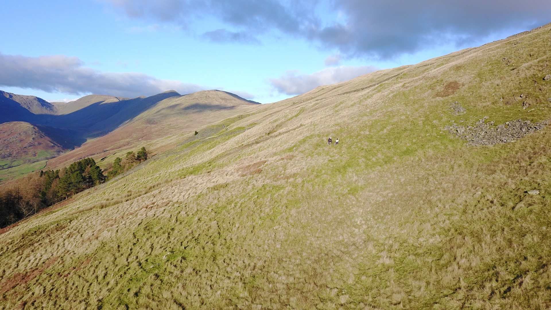
| Looking to the north up the Kentmere ridge with 2 people sitting in the take off area. Its a big area with plenty of room |
 |
| Take off in the left of centre looking to the south |
 |
| Magnificent country to fly in! Looking north up the Troutbeck Valley with the Kentmere ridge on the right. |
 |
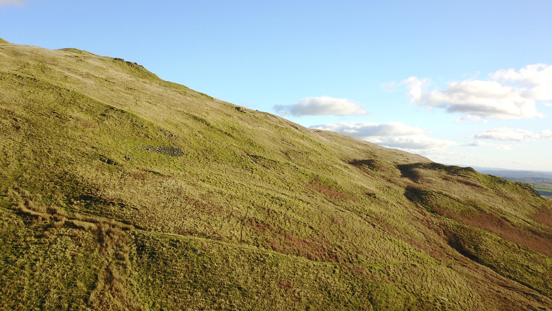
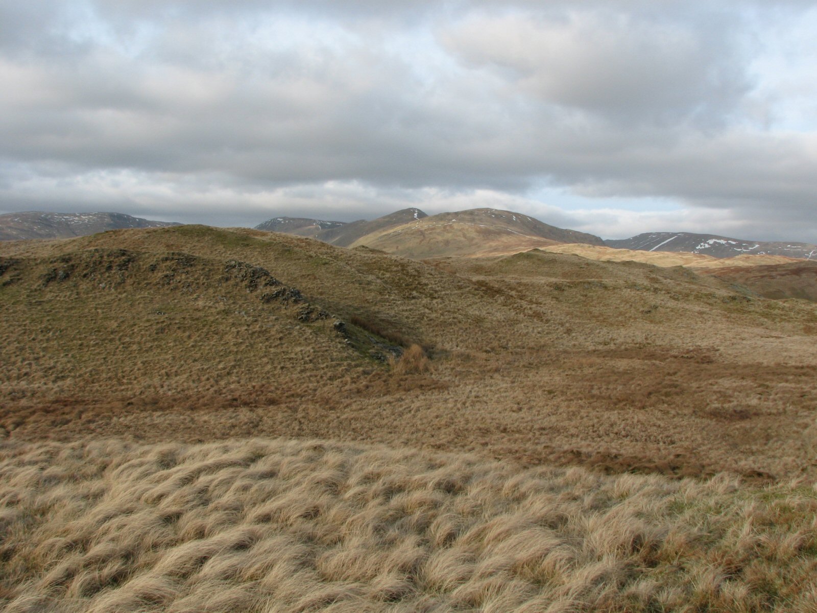
| The "gnarly" top landing area at Troutbeck.Care is needed here as there a number of small peaks with steep ground between them. |
 |
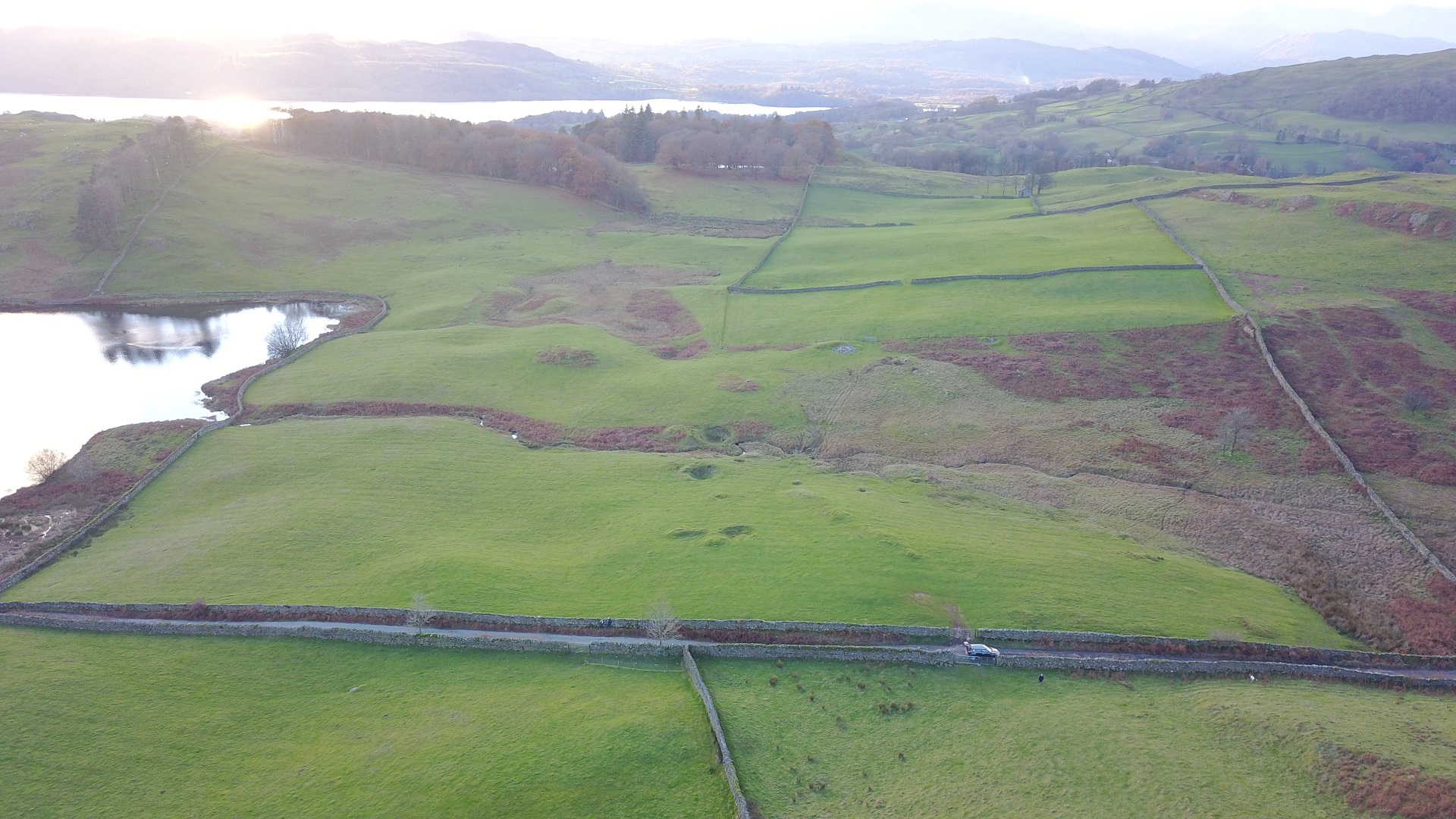
| The landing area by Dubbs Reservoir. The ground does slope away after the levelish bit to the right of the car. |
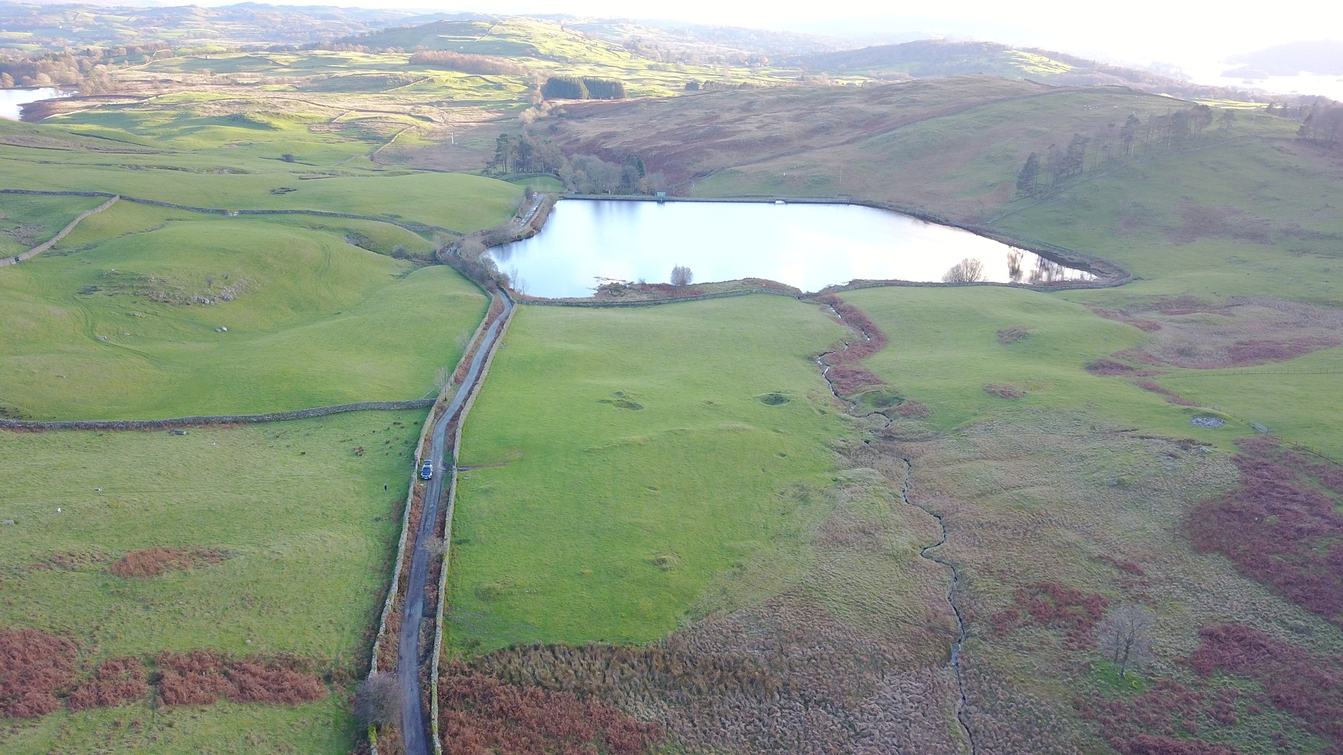 |
| A view of the landing area looking to the east. In 2017, the gate by the car was on its last legs with the top hinge missing. Treat it carefully. The field slopes more than is apparent in the photos |
 |
Local Information - Pubs/Food etc
Nearest pubs to the site - for post flying debriefing only! You may find details of other facilities here
No pub details are available for this site. Send your recommendations to the webmaster.
This page shows records for this site. Some of the older records are not very detailed. More recent records may have an igc file available You can right click and download this to your PC. You can then use IGC Flight replay to view the flight.
| Paragliding |
| FAI Triangle | |
| Distance : | 24.0km approx |
| Date : | 1995 |
| Pilot : | Burkitt Rudd |
| Notes : | Flight combining Stony Cove Pike and Loughrigg Fell with the takeoff ridge |
| Open Distance XC | |
| Distance : | 37.8km |
| Date : | 23/05/2004 |
| Pilot : | Jim Stilling |
| Notes : | Landing near Garsdale Head |
| Hang Gliding |
| Open Distance XC | |
| Distance : | 48.3km |
| Max Height : | 4500ft |
| Date : | Unknown |
| Pilot : | Unknown |
Data Resources
Follow the links to see the site in Google Earth and Google Street view. To access the former, you will need to have Google Earth installed on your PC. You can also upload your flights to GE - use GPS Dump (Links Page) to convert a variety of GPS file formats to a GE kml file.
| Link | Resource Type | Notes |
|---|---|---|
| Google Earth - Car Park | ||
| Google Earth - Car Park 2 | ||
| Google Earth - Take Off | ||
| Google Street View - Parking | The start of the Dubbs Road which is an unmetalled road. As you can see, they were repairing the track in 2010 - but this will only go as far as the reservoir. |
Troutbeck Map |
Legend |