W - WNW |
Lowca |
| Status : | OK | ||
| IMPORTANT - Restrictions on use | If any horses become seriously disturbed by your flying, PLEASE leave that area immediately and inform the club's sites officer. This is usually only a short term problem with new horses but the club needs to know. |
||
| Last Updated : | 29/03/2026 at 02:14 by Rick Livingstone | ||
| Wind : | W - WNW | ||
| Nil Wind : | No | ||
| Grid Ref : | NX980215 | Height (AMSL) : | 195' / 60m |
| Site Code : | 17.068 | Top to Bottom : | 195' / 60m |
Location
W Coast - N of Whitehaven
Details
A pleasant change from the inland sites. It doesn't appear too inspiring but actually works well.
Can often be flown when inland sites are blown out.
Suitable for training & novice CPs as long as they don't stray from the site and they respect windy days.
It's a good site to scrub up your CP skills if you're rusty!
Site Officer
:
Postcode for Sat Nav Systems (read the Health Warning!)
CA28 6QH - This is the closest mail delivery point to the flying site and is positioned at:
The junction of the north/south road with East Road; this was where the Post office used to be. The road to the west leads to the parking area.
Getting There
Approach from the A595 to the village of Lowca. The road to the site starts at the war memorial and goes west past the rugby pitch. Note that the post office shown on the map is now closed.
Getting to takeoff
Top drivable!
Permission to use site
N/A
Hazards
Suitable for novice CPs as long as they don't stray from the site and they respect windy days.
Beware the railway, don't fly low over it, or land, or walk along the tracks.
Beware barbed wire fences behind and in front of take off.
Remember the bottom landing is off to the south, if you are getting low, slope land or make for the beach early!
Don't fly too far north in marginal conditions, no beach just slabs/boulders.
If going North, take care flying past the wind turbines.
Take Off
A friendly site frequently used for training. Take off is smooth and grassy, some places need ground handling skills to cross the lip of the top terrace.
Re Hang Gliders: The original hangie take off is now in a horse paddock and is unavailable, so you'll be mixing take offs with floppies and trainees... please make allowances! Otherwise the site is straightforward in most respects but don't go too far north if low. Only safe bottom landing is south of takeoff. PLEASE PARK HANG GLIDERS AWAY FROM TAKE OFF/LANDING AREAS AT ALL TIMES.
Landing Areas
The bottom landing is to the south on the beach.
There is usually sufficient space to land above high water mark.
Top landings are back at take off. If it is windy enough to be blown back then consider landing down on the beach.
Flying
See hazard notes.
XC potential
A ridge run north to Harrington is possible when conditions are good, a breeze with a bit of north helps (WNW). You will need to negotiate flying in front of wind turbines and bottom landings can be difficult (steep scrubby banks, railways, bouldery beaches or the sea) so take care.
Flights south to Whitehaven, and even St Bees, have been achieved by the experienced and/or brave pilot, it does involve some difficult transitions and watery glides!
Photos
Click on the photo for a full size image.
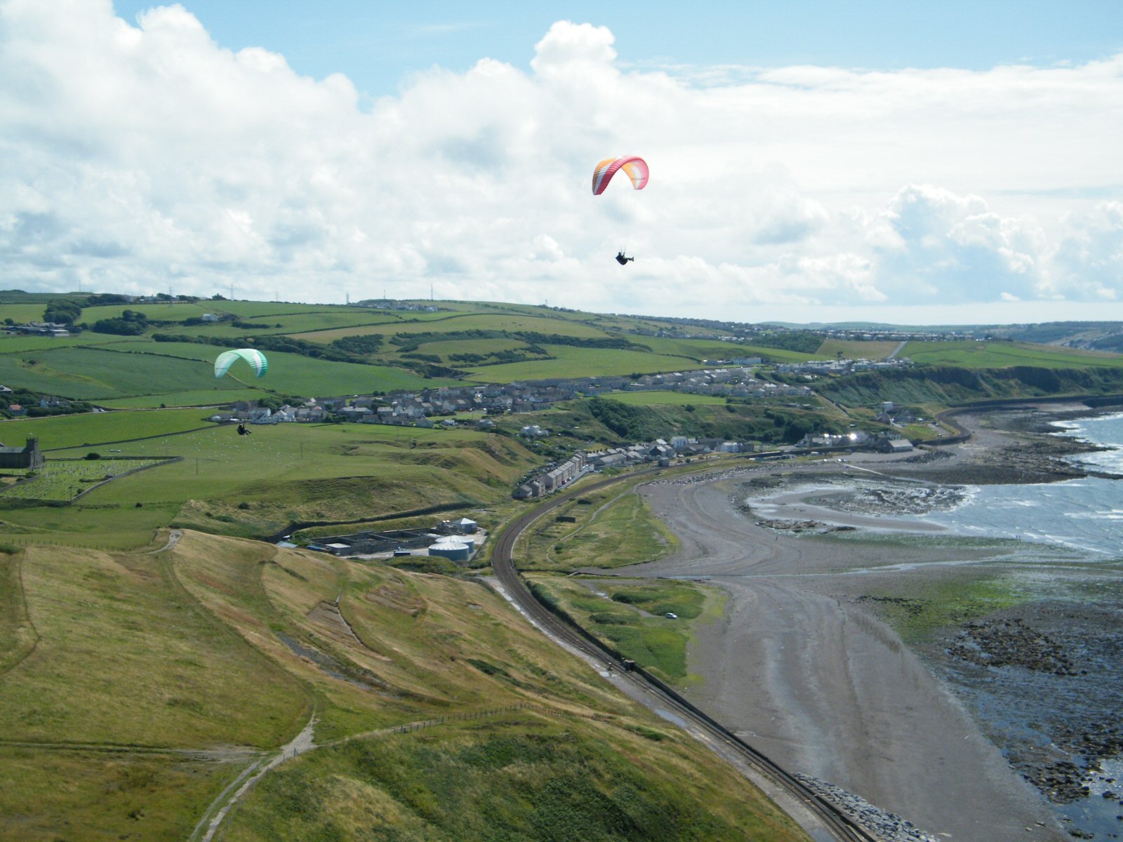
| The view to the south. Parton village is in the centre of the picture. Photo by Pete Rycroft |
 |
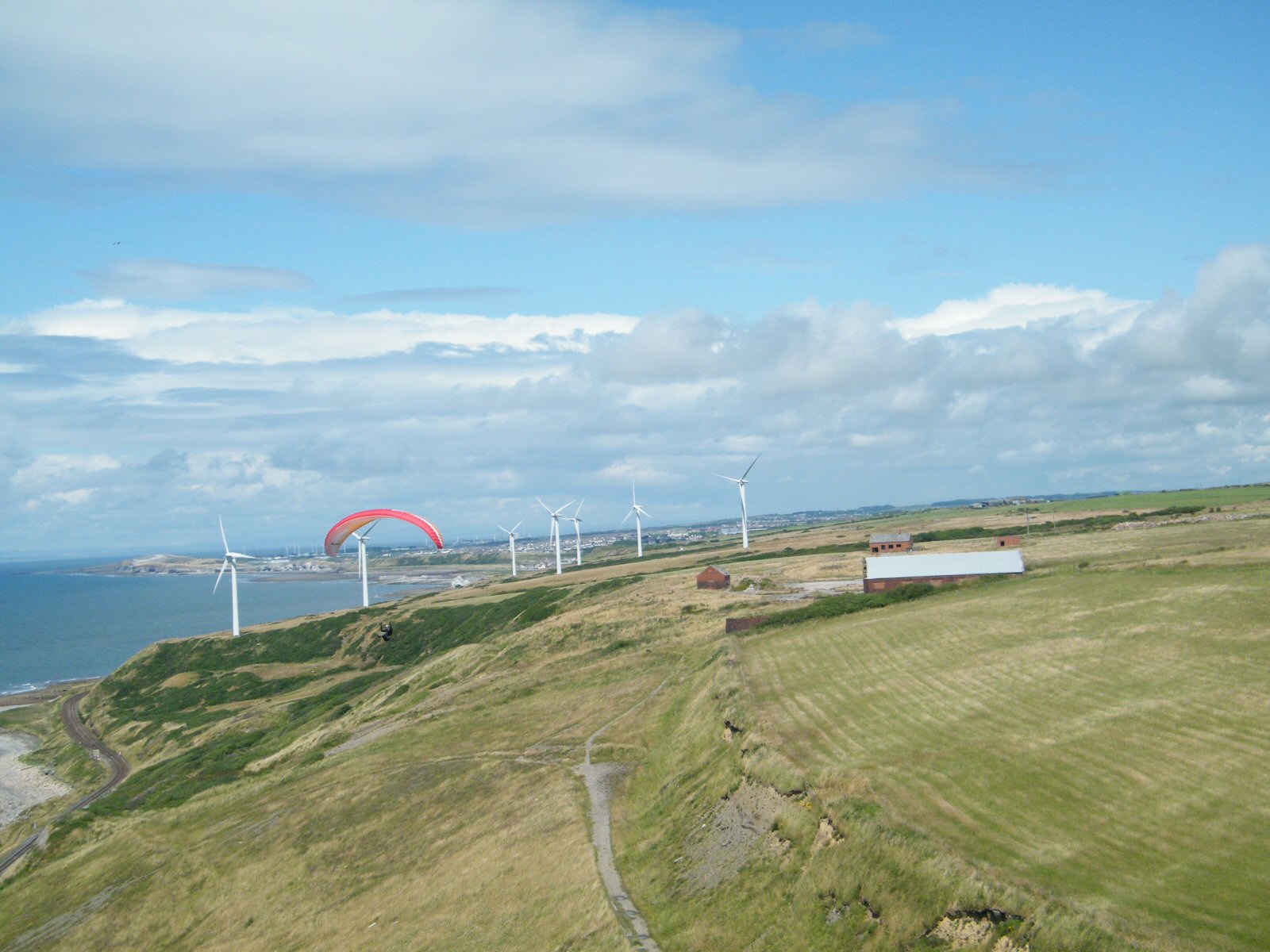
| The view to the north, Workington in the far distance. Photo by Pete Rycroft |
 |
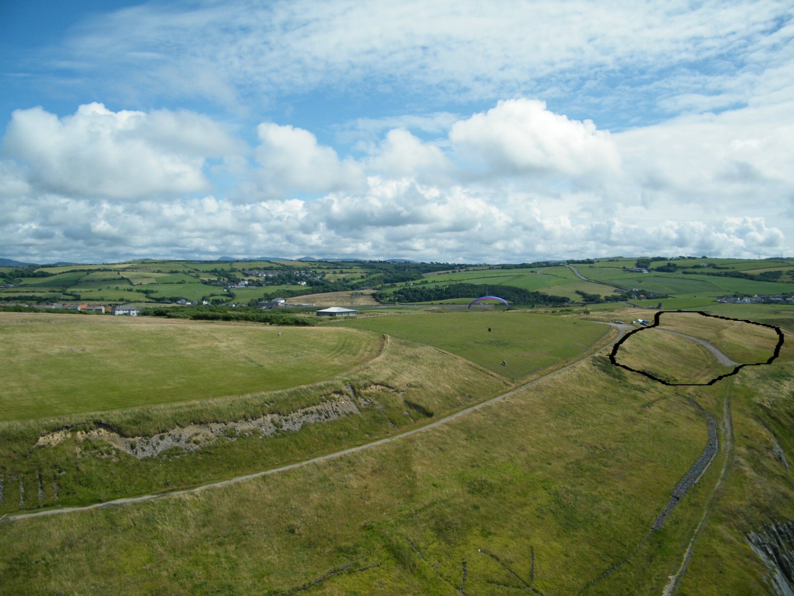
| The take off and landing area at Lowca. The area to use is to the right of where the cars are parked - to the right of the paraglider. Use the brownish area above and below the track running 4 o'clock from the cars as indicated by the black line. Photo by Pete Rycroft. |
 |
Local Information - Pubs/Food etc
Nearest pubs to the site - for post flying debriefing only! You may find details of other facilities here
No pub details are available for this site. Send your recommendations to the webmaster.
This page shows records for this site. Some of the older records are not very detailed. More recent records may have an igc file available You can right click and download this to your PC. You can then use IGC Flight replay to view the flight.
| Paragliding |
| Turn Point Ridge Run | |
| Distance : | 10.3km |
| Max Height : | 512ft |
| Date : | 13/07/2011 |
| Pilot : | Rick Livingstone/Malcolm Grout |
| Notes : | Igc file is in the XC League. Malcolm Grout flew on to St Bees, but hasn't claimed the record or produced an igc file! Lowca was flown a lot by the hangie boys in the early days of foot launched flying but there are no flight details....... |
| Hang Gliding |
No hang gliding records available for this site
Data Resources
Follow the links to see the site in Google Earth and Google Street view. To access the former, you will need to have Google Earth installed on your PC. You can also upload your flights to GE - use GPS Dump (Links Page) to convert a variety of GPS file formats to a GE kml file.
| Link | Resource Type | Notes |
|---|---|---|
| Google Earth - Car Park | ||
| Google Street View - Parking | Turn right for the track leading to take off |
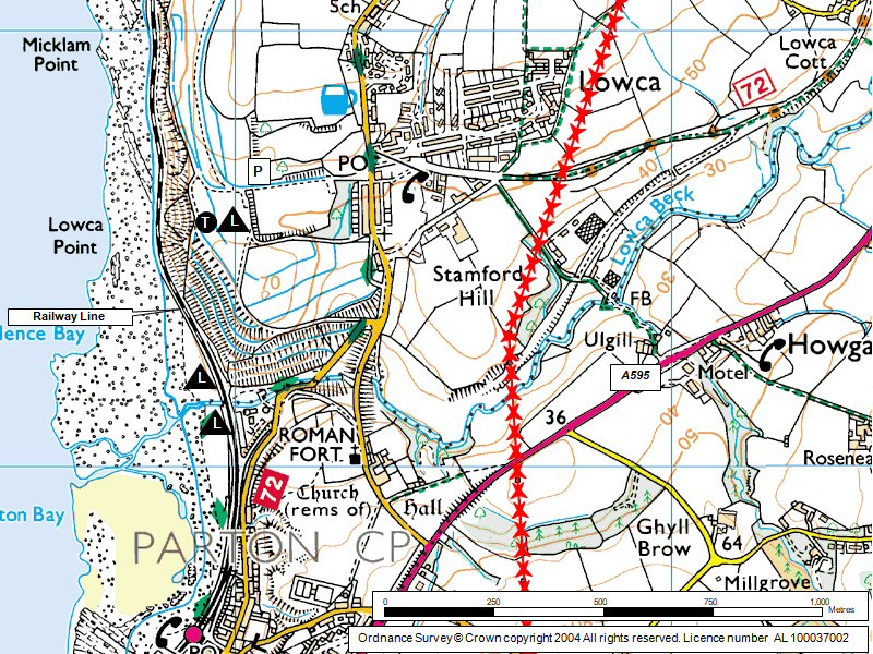
Lowca Map |
Legend |