ESE - SE |
Barkin Fell |
| Status : | OK | ||
| IMPORTANT - Restrictions on use | A new (2015) fence has been erected immediately after the second gate and crosses the boggy area before going up the hill. You used to stay to the right of a derelict wall before crossing over the wall before starting up the hill. Please use the new gate (see site map) on the left immediately after going through the second gate as there is no way through further on. The farmer is quite OK with our activities but asks that we don't climb over walls and fences. Take off at the very top of the hill. Alternatively, you can use the field to the left of the walk up path - there's a small group of trees in this field not far from the fell wall. NO SCRATCHING near to sheep and lambs - stay well away from all livestock. There is a number limit of ten people on the fell, flying or otherwise. DO NOT walk through, land in or over-fly the field marked as 'out of bounds'. No flying is permitted within two hundred metres of the Combe (NE bowl) during the nesting season. Limited roadside parking. DO NOT obstruct the road or field gates. No school use. |
||
| Last Updated : | 05/02/2021 at 03:32 by Rick Livingstone | ||
| Wind : | ESE - SE | ||
| Nil Wind : | Yes | ||
| Grid Ref : | SD675870 | Height (AMSL) : | 1640' / 500m |
| Site Code : | 17.053 | Top to Bottom : | 625' / 191m |
Location
SE - Between the Lune and Dentdale
Details
An excellent site consisting of a grass and heather covered ridge that extends for 6km. The carry up is steep in places and sustained however the effort is well worth it. The site can be silky smooth or gut wrenchingly rough.
Site Officer
Andy Plimmer : 07974641924
Postcode for Sat Nav Systems (read the Health Warning!)
LA10 5TA - This is the closest mail delivery point to the flying site and is positioned at:
The bridge at Gawthrop about 1 mile to the North East and down the hill from the car parking.
Getting There
Leave the A65 at Kirby Lonsdale and travel north approx. 4km to Barbon to the east of the A683. Pass through Barbon village heading out on the minor road towards Gawthrop and Dent. This road passes up through Barbondale with the main ridge of Barkin rising steeply on the left. Limited parking can be found in the side of the road before it drops steeply towards Gawthrop.
Getting to takeoff
From the parking area, follow the footpath through the gate into the field beyond. Contour around the hillock and once through the next kissing gate, look for a gate on the left and go through it. With the fence on your right, head for the small enclosure of trees up on the fellside. A set of vehicle tracks mark the route up. The take off area is close by the small enclosure or above the next wall out on the open fell. DO NOT take off or overfly at low level the field immediately to the right of take off (looking away from the hill).
Permission to use site
Foulsyke Farm / High House Farm
Hazards
Beware of a marked wind gradient and do not be tempted to take off low down in less than ideal conditions. The area behind the ridge is full of deep gulleys and getting blown back is not an option! The site can become very thermic particularly over areas of scree. Military jets use the area mid week and have been known to fly along the valley at below ridge top height. The site can be affected by sea breeze that causes the wind to rapidly switch such that it then blows over the back. A windsock in the landing area is definitely recommended. Wave does occur occasionally when it can be very bouncy and very nice depending on the day.
Take Off
Any where from the small clump of trees upwards. It is easier and better to check the breeze higher up so the best take off is above the top wall.
Landing Areas
Land in the bottom a bit soggy, or by the Limestone outcrops in the field just by the road. Avoid the out of bounds enclosure the farmer is not very supportive. Can be rough coming into land if there is any sort of breeze.
A wind sock is very useful.
Flying
Big ridge with lots of potential, good down wind routes into the Lakes and up along the M6. Can be very strong and thermic with wave potential. Don't flop over the back low down it's a long walk and very sinky. Excellent evening soaring up and down the ridge. The NE bowl used to be flown but recent conservation efforts make this too intrusive for the wildlife. Good pub in Barbon village.
XC potential
Excellent. The coast at Ravenglass lies approximately 60km away and a more northerly track leads to the Scottish borders.
Videos
This video is a 360 panorama of the top take off position at Barkin Fell. The camera operator (in the centre of the frame) is sitting at his normal position for take off. The video concludes with a short flight down the ridge. A second video shows the landing field approach. The camera is initially sited to the NE of the formal landing field, looking SW. The camera pans round to the right to view the hill. The track you can see on the near side of the wall/fence is not the walk up path. You need to be on the other side of the wall. The camera then moves up the landing field. The bottom left of the landing field is the driest bit, the rest can be very boggy. The camera then flies over the approach track field ending at the gate and car parking. The approach track field is a good place for a windsock. The video can be found on the Vimeo web site
Photos
Click on the photo for a full size image.
| Looking SW down the Barkin ridge from roughly above take off. The high point is Calf top (with trig point) at 609 metres |
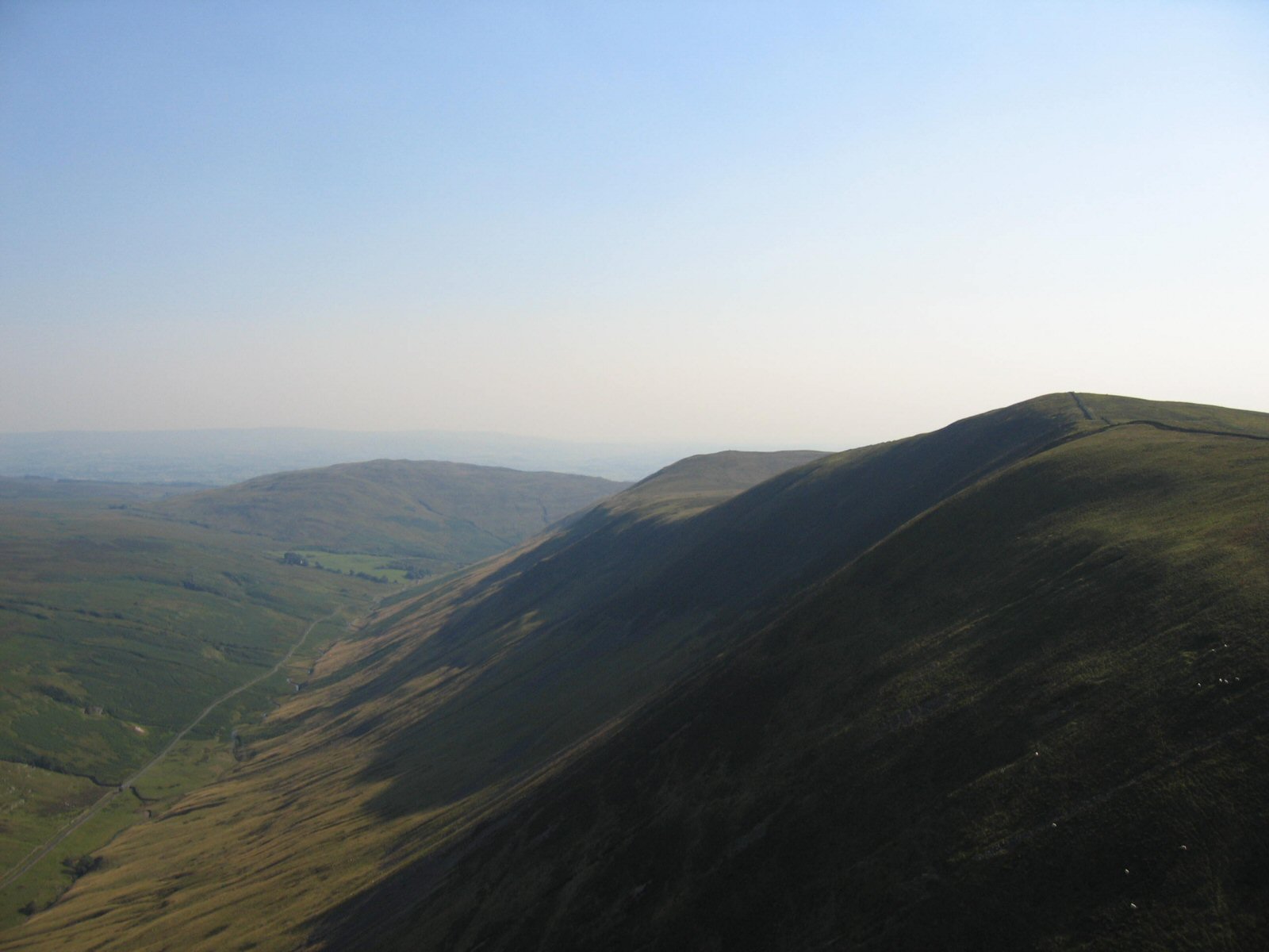 |
| From the south westerly end of the ridge looking back up NE. Take off is roughly at the end of the visible ridge where the edge of the shadow meets the ridge line |
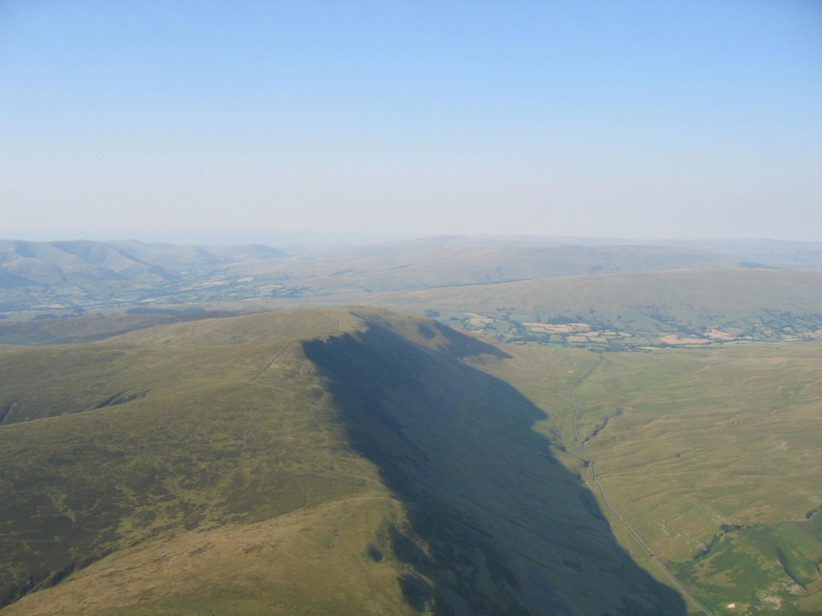 |
| Looking down on the take off area which is in the walled area in the middle and left of picture. The area close to the wall running across the picture is used above the area of shadow. |
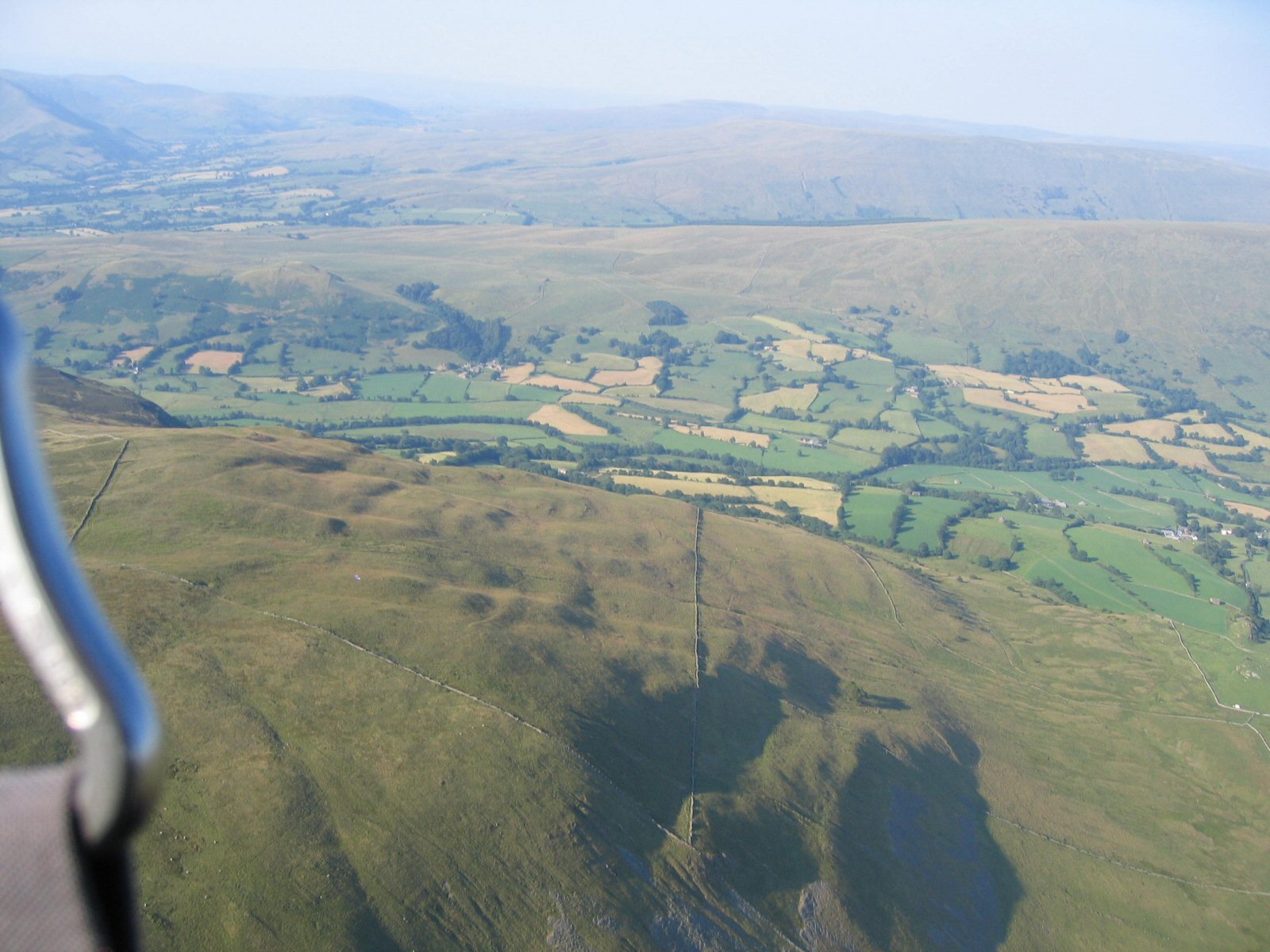 |
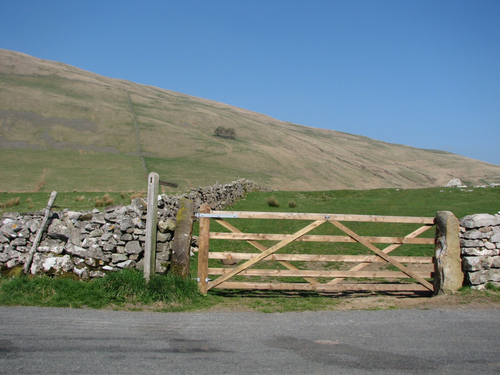
| In Spring 2009 Andy Plimmer and Ed Cleasby rebuilt the gate from the road. The old one was in a poor state and the new one is a fine job. Andy reports that getting the gate posts in was a bit of a challenge! |
 |
Local Information - Pubs/Food etc
Nearest pubs to the site - for post flying debriefing only! You may find details of other facilities here
| Sun Inn, Dent | |
| Grid Reference : | SD704870 |
| Distance from Site : | 1.8 miles |
| Notes : | Right in the centre of Dent village. Excellent beer! |
| Click here to go to the web site | |
| Click here to see the place in Google Street View | |
| George and Dragon, Dent | |
| Grid Reference : | SD705869 |
| Distance from Site : | 1.9 miles |
| Notes : | On the next corner east from the Sun Inn, this pub is owned by Dent Brewery - excellent beer. |
| Click here to go to the web site | |
| Click here to see the place in Google Street View | |
| The Pheasant Inn, Casterton | |
| Grid Reference : | SD623795 |
| Distance from Site : | 6.4 miles |
| Notes : | Bit of an uninspiring pub on the A683 north of Kirkby Lonsdale.This is the nearest pub if you're heading back west from the site. |
| Click here to go to the web site | |
| Click here to see the place in Google Street View |
This page shows records for this site. Some of the older records are not very detailed. More recent records may have an igc file available You can right click and download this to your PC. You can then use IGC Flight replay to view the flight.
| Paragliding |
| FAI Triangle | |
| Distance : | 30.9km |
| Date : | 09/10/2012 |
| Pilot : | Phil Wallbank |
| Notes : | |
| IGC File : | Right click to download |
| Open Distance XC | |
| Distance : | 97.0km |
| Date : | 08/04/2023 |
| Pilot : | John Hamlett |
| Notes : | Took off at south end of the ridge, flew via Howgills - Eden Valley - Hartside Pass, landing just over the Scottish Border at Canonbie. 104.5km via three turn-points. Max alt 5781ft. Duration 4hrs 4mins. Ozone Rush 4. |
| IGC File : | Right click to download |
| Hang Gliding |
| Open Distance XC | |
| Distance : | 57.9km |
| Max Height : | 5500ft |
| Date : | Unknown |
| Pilot : | Unknown |
Data Resources
Follow the links to see the site in Google Earth and Google Street view. To access the former, you will need to have Google Earth installed on your PC. You can also upload your flights to GE - use GPS Dump (Links Page) to convert a variety of GPS file formats to a GE kml file.
| Link | Resource Type | Notes |
|---|---|---|
| Google Earth - Car Park | ||
| Google Earth - Landing | ||
| Google Earth - Take Off | ||
| Google Street View - Parking | Go through the (CSC) gate on the right to get to take off |
Barkin Fell Map |
Legend |
