SW - WSW |
Silecroft |
| Status : | OK | ||
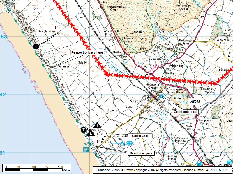
| IMPORTANT - Restrictions on use | Don't hang around in front of Summerhills - please respect the residents privacy.No dogs allowed onto the site. Please refrain from driving vehicles on to site. The farmer has requested that we park off the track alongside the fence where there is a small strip of grass about the width of a car, better still park in the main Carpark. |
||
| Last Updated : | 15/12/2021 at 19:16 by Ian Henderson | ||
| Wind : | SW - WSW | ||
| Nil Wind : | No | ||
| Grid Ref : | SD118815 | Height (AMSL) : | 40' / 12m |
| Site Code : | 17.055 | Top to Bottom : | 40' / 12m |
Location
SW Lakes - N of Millom
Details
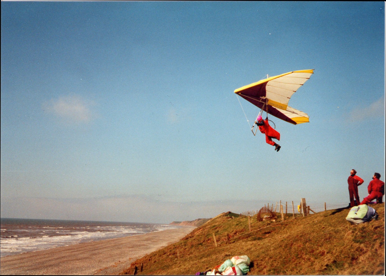
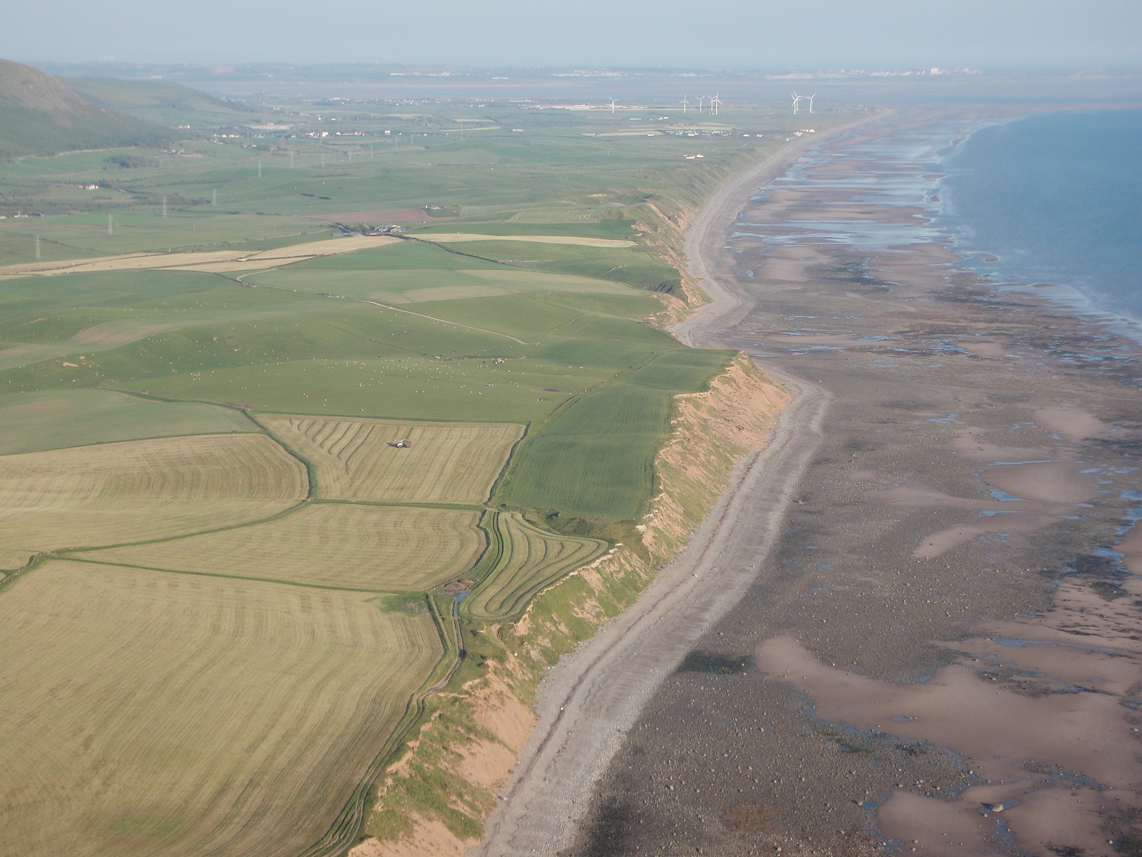
A convenient low level place when other sites are blown out (ie "the Combe"). New fencing has meant a low level take-off, although a better take off now exists a mile further north via a different approach. Generally very smooth with good lift that allows the site to be extended 3.5 km to the north with small "challenges" on the way. Sea thermals can provide good height gains which allow the "Combe" to be gained.
Local Sites Contact - Keith Paterson mobile 07841 056727
Site Officer
Keith Paterson : 07841056727
Postcode for Sat Nav Systems (read the Health Warning!)
LA18 4NX - This is the closest mail delivery point to the flying site and is positioned at:
The postcode centre is the telephone box near the end of the road from Silecroft to the beach. Carry on a bit further and turn right into the car park.
Getting There
Turn off A5093 at Silecroft and follow minor road towards the beach. Turn right down a track after 500m. Park after 150m Keep track clear.
Getting to takeoff
Can be walked from the beach car park to south end take off. Alternatively, it can be driven via a track that starts 100m before the beach car park (goes to Summerhills). Park by second gate. North end ... drive a road/track to buildings and walk in. Take off is 120m N of Summerhils.
Permission to use site
Whitbeck (for access and take off south end.)Townend Farm, Whitbeck (access and take off north end)
Additional Safety Notes
Check the state of the tides. Don't scratch.
Paragliding
This is a good safe site but take care on launch if windy due to compression (there can be no wind at the base of the banking but on the crest, 30'/ 10m higher it can be 15 - 20mph!). Avoid flying low in front of Summerhills as the residents like their privacy.
Hang Gliding
No problems but easy to mess up the low level launch and end up on the beach so avoid high tide! Don't scratch; if below the top then go down, land and walk the glider back up. Good top landing.
XC potential
Limited but there is potential if the "Combe" can be gained.
Videos
https://www.youtube.com/watch?v=LxTgSiyRmA4 https://www.youtube.com/watch?v=Q0TOpuTrxcc
Photos
Click on the photo for a full size image.
Local Information - Pubs/Food etc
Nearest pubs to the site - for post flying debriefing only! You may find details of other facilities here
| Miners Arms Silecroft | |
| Grid Reference : | SD131419 |
| Distance from Site : | 1.1 miles |
| Notes : | Great food, beer garden |
| Click here to go to the web site | |
| Click here to see the place in Google Street View |
This page shows records for this site. Some of the older records are not very detailed. More recent records may have an igc file available You can right click and download this to your PC. You can then use IGC Flight replay to view the flight.
| Paragliding |
| Open Distance XC | |
| Distance : | 5.9km |
| Date : | 03/06/1995 |
| Pilot : | Shaun Ainley |
| Out and Return | |
| Distance : | 11.2km |
| Date : | 2004 |
| Pilot : | Ian Bertram? |
| Notes : | Has been completed by many pilots though possibly Barty being the first. |
| Hang Gliding |
No hang gliding records available for this site
Data Resources
Follow the links to see the site in Google Earth and Google Street view. To access the former, you will need to have Google Earth installed on your PC. You can also upload your flights to GE - use GPS Dump (Links Page) to convert a variety of GPS file formats to a GE kml file.
| Link | Resource Type | Notes |
|---|---|---|
| Google Earth - Car Park | ||
| Google Earth - Car Park 2 | ||
| Google Street View - Parking | The car park at Silecroft |
Silecroft Map |
Legend |


