SW - WSW |
Murton Pike |
| Status : | OK | ||
| IMPORTANT - Restrictions on use | All pilots must comply with the following requirements of the MOD licence: 1. Fly with a GPS device that shows restricted airspace and remain clear of the danger area at all times. 2. First pilots of the day to phone the Warcop guard room on 01768 343236 and ask for the number for the Duty Range Safety Officer to ask for permission to fly (there will be occasional reasons to not allow flying that include the use of the dry training area by helicopters and other VTOL aircraft). 3. Fly with a VHF radio tuned to the CSC frequency of 143.700 (please do not use other club frequencies until leaving the site) and please carry a mobile phone in case you need to contact the guard room. 4. Please review the range safety briefing by following this link, the hazard notes on the flying tab above, and if for any reason you do land in the prohibited area when the red flag is flying, immediately call the guard room with your position 5. Do not touch any strange items, pick up, or remove any objects even if you believe them to be safe. 6. Call the guard room at the end of the day to confirm flying activities are completed. 7. Please check the forum for information. Please post details if you intend to fly and where possible agree who will call for permission. |
||
| Last Updated : | 05/02/2021 at 04:08 by Rick Livingstone | ||
| Wind : | SW - WSW | ||
| Nil Wind : | No | ||
| Grid Ref : | NY729219 | Height (AMSL) : | 1640' / 500m |
| Site Code : | Top to Bottom : | 755' / 230m | |
Location
Pennines - East of Appleby
Details
Murton Pike has been an informal paragliding and hang gliding site for more than 30 years, and has been take-off for many notable XC flights. Murton Pike is owned by the MOD and is a publicly accessible dry training area adjacent to the live-firing Danger Area and Class D restricted airspace D407 associated with Warcop Training Camp. Intensification of training at Warcop has led to serious concerns about occasional unlawful use by paragliders. CSC is fortunate to have been given an opportunity to trial a licence for 12 months with the MOD to use the site lawfully, on the basis that we can demonstrate well managed access and reduce the risk of infringement of restricted areas. We can only achieve this with the help of all club members and visiting pilots complying with the Site Restrictions of Use.
Units training at Warcop are responsible for safety whilst they are using the range and are briefed a month ahead of their visit. The safety brief will in the future include details of fliers using the site so that personnel responsible for range safety know we are there, and know that we are well briefed, so that they do not inadvertently stop training when they see wings in the air.
The information in this site guide is being used both ways to learn how to operate this licence. Please feedback any comments to the CSC site officer so that this can be used to adapt how we operate the licence in the future.
Site Officer
Alistair Maltby : 07736 364478
Postcode for Sat Nav Systems (read the Health Warning!)
CA16 6ND - This is the closest mail delivery point to the flying site and is positioned at:
The postcode takes you to the middle of the village down hill from the car park.
Getting There
There are several ways to get to the village of Murton but by far the easiest is to go to Appleby-in-Westmorland and follow the signs to Hilton & Murton. These can be easily seen in both directions from the road that goes straight through the town on the East side of the river.
Any route to Murton will take you to the crossroad in the middle of the village. From here you will clearly see the route directly uphill to the car park at the foot of the fell.
Getting to takeoff
Access the Pike via the obvious track that runs from the car park at the top of Murton village and contour to take off depending on wind conditions.
Permission to use site
Permission to use the site is via a 12 month trial licence from the MOD that will be under close scrutiny and adapted as required. Please check back to the site guide and forum each time you fly to ensure you are current with Restrictions of Use. Please review the safety briefing and note any instructions relating to hazards. Warcop Training Area is under intensive use by many different units, sometimes under very short notice. Please report any incidents to the CSC site officer, positive or negative, to facilitate the ongoing management of the site, and the review of the trial.
Hazards
The main hazards associated with this site is the risk of infringement of Danger Area and Class D airspace D407.
Please review the safety briefing by following this link. Do not touch any strange items, and do not pick up or remove anything, even if you believe them to be safe. No trophies (this includes parachute flare chutes).
Fly with a GPS device to ensure you remain clear of restricted airspace. If for any reason you land in the Danger Area when it is active, do not move before calling the guard room with your position, and wait for instruction. Do not attempt to sneak out. Warcop would rather halt firing to get you out, than for you to risk your life.
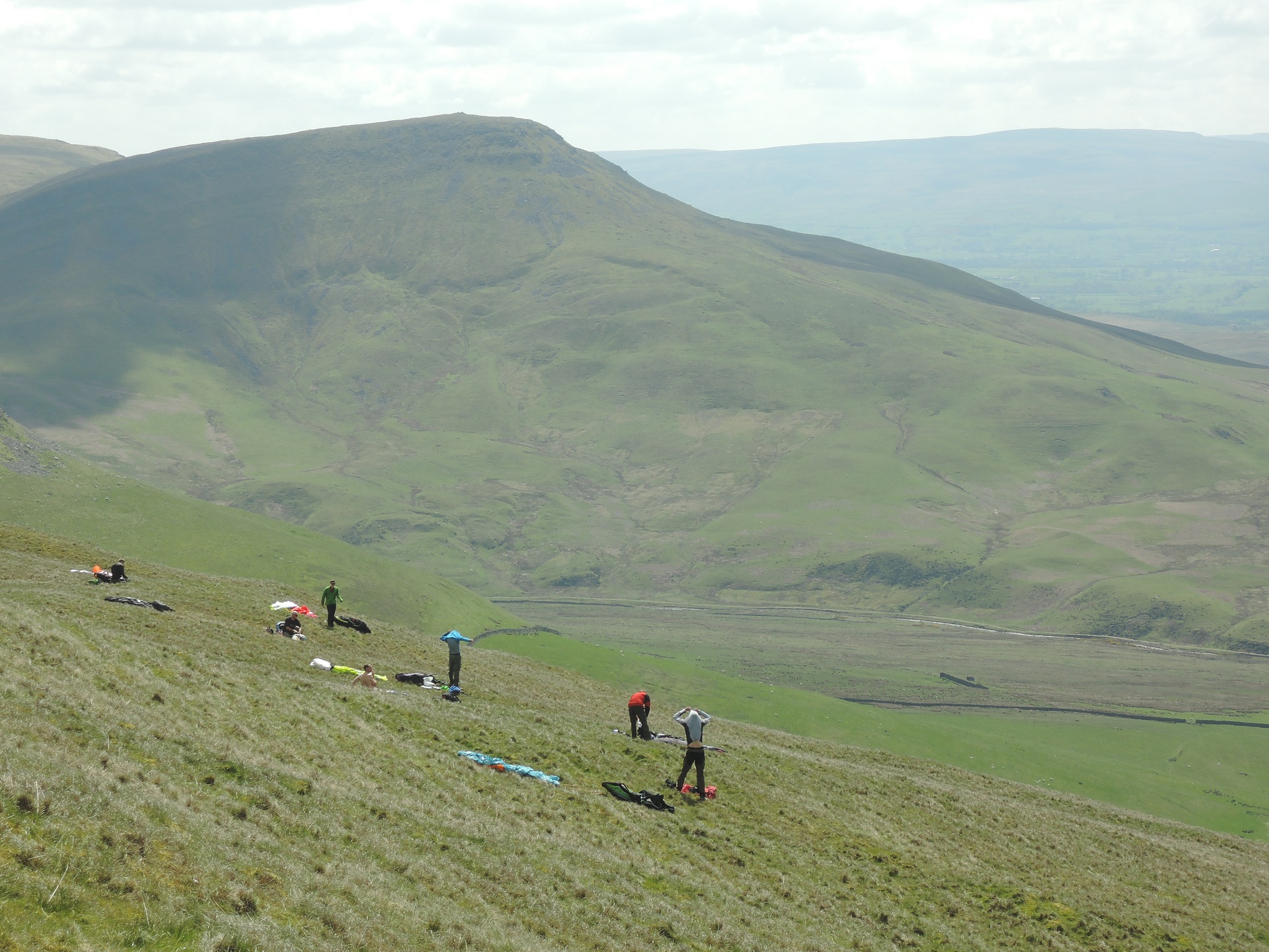
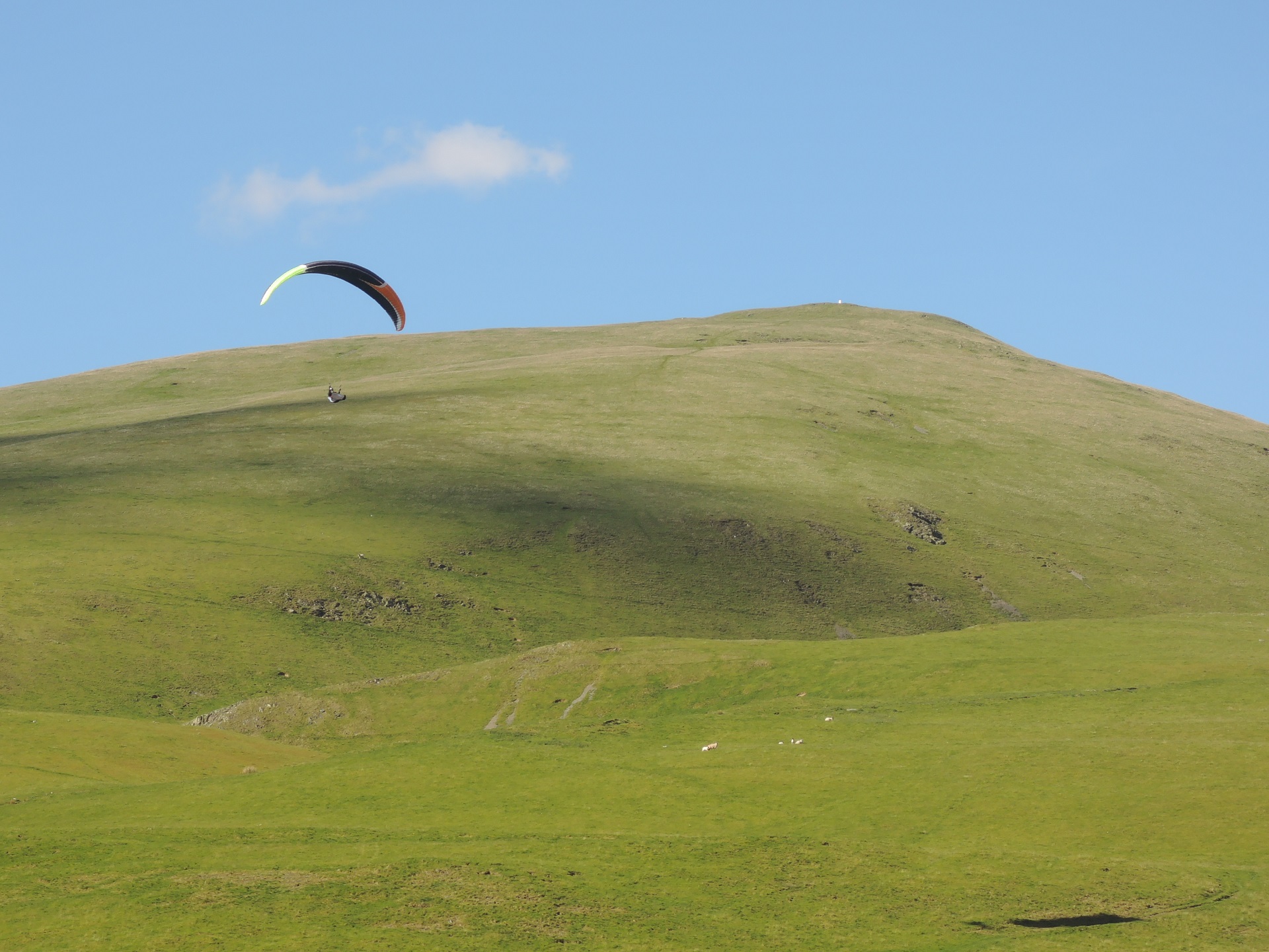
Take Off
Take off can be anywhere on the main, grassy slopes that leads up to the summit. The wind strength and direction dictates the level and position of take off. It is not unusual to walk to the very top ... a fair hike! There are very few hazards of any sort and top/slope landings are easy almost anywhere.
Note all the previous references to the D407 Danger Area.
Landing Areas
There are large, open areas close to the access gate/carpark. The ground slopes very slightly towards the gate and stonewall but presents no problem.
Flying
Murton will soar OK, but is principally a thermal site and pilots intending to fly here should feel competent enough to read and use the brief thermal windows. Early in the day the wind is often off to the north, but generally swings increasingly onto the main face as the thermal cycles strengthen. Early to mid afternoon provides the best climbs ... later the wind settles and often strengthens from the SW and the return from an out and return has to battle against this in weakening climbs.
Flying north along the ridge usually provides regular climbs with a soarable section of ridge as a Plan B. If Plan B fails the walk-out and retrieve can be awkward given the myriad of small roads. The Cross Fell Pennine range and Eden valley are well known for convergence as the Solway influence makes its present felt from mid afternoon. In a genuine SW airflow the Morecambe Bay SB can push in and also create stronger conditions around launch.
XC potential
Due to its rather conical shape Murton is primarily a cross country site. Warcop Danger area cuts off (without permission to transit) escape to the south and directly over the back is rather daunting with a long walk-out and difficult retrieve; as a result almost all XC flights go north along the main ridge. Although many flights north end up being open distance, a significant number (and often the main challenge) of Murton is the lengthy out and return or triangles that push out into the Eden valley.
Photos
Click on the photo for a full size image.
| The Cross Fell ridge extending NW as seen from Murton Pike. Dufton Pike is the cone shaped hill on the left. Photo by John Hamlett. |
 |
| Take off on Murton Pike looking SE. The prominent Mell Fell is within the danger area. Photo by John Hamlett. |
 |
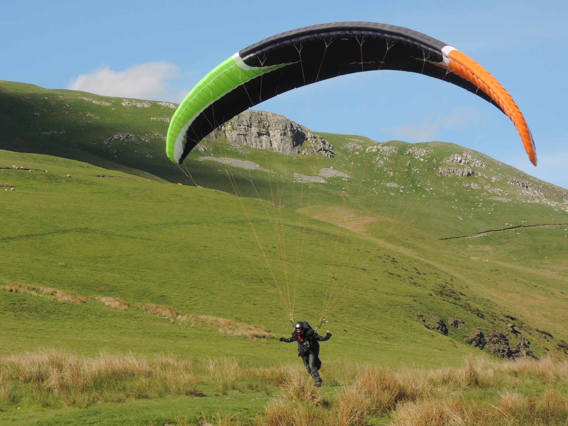
| Murton Pike with Ed Cleasby on landing approach. Photo by John Hamlett. |
 |
| Ed Cleasby landing at the foot of Murton Pike. Photo by John Hamlett. |
 |
Local Information - Pubs/Food etc
Nearest pubs to the site - for post flying debriefing only! You may find details of other facilities here
| Midland Hotel, Appleby | |
| Grid Reference : | NY686206 |
| Distance from Site : | 4.3 miles |
| Notes : | A "CAMRA award winning" free house pub/hotel next to the srtation in Appleby. Food and accommodation is available |
| Click here to go to the web site | |
| Click here to see the place in Google Street View | |
| Stag Inn, Dufton | |
| Grid Reference : | NY 68959 |
| Distance from Site : | 6.0 miles |
| Notes : | Lovely country pub with real ales and good food. |
| Click here to go to the web site | |
| Click here to see the place in Google Street View |
This page shows records for this site. Some of the older records are not very detailed. More recent records may have an igc file available You can right click and download this to your PC. You can then use IGC Flight replay to view the flight.
| Paragliding |
| Out and Return | |
| Distance : | 72.0km |
| Date : | 30/04/2013 |
| Pilot : | Mike Cavanagh/Steve Etherington |
| Notes : | A ridge run up the Pennines from Murton Pike to south of Brampton and back to Murton Pike. This was the UK record for a short while |
| Hang Gliding |
No hang gliding records available for this site
Data Resources
Follow the links to see the site in Google Earth and Google Street view. To access the former, you will need to have Google Earth installed on your PC. You can also upload your flights to GE - use GPS Dump (Links Page) to convert a variety of GPS file formats to a GE kml file.
| Link | Resource Type | Notes |
|---|---|---|
| Google Earth - Car Park | The car park has been improved since the Google Earth image was last checked (image date Jan 2004 - checked Jan 2018) | |
| Google Earth - Landing | The landing field slopes, a windsock is also recommended | |
| Google Earth - Take Off | There's a broad expanse of hill for take off so there's plenty of choice. Some flights have started much lower | |
| Google Street View - Parking | The car park with the gate to the fell on the left |
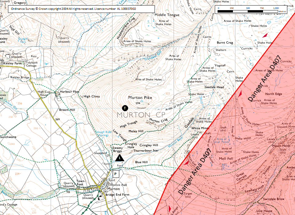
Murton Pike Map |
Legend |